 vesseltracker.com
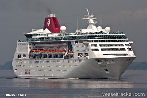
Vessel EMPRESS OF THE SEAS IMO: 8716899, MMSI: 311000515 Cruise Ship
UTC, 15.41661, 73.79132, course: 198, speed: 0
UTC, 15.41661, 73.79132, course: 198, speed: 0
2026-02-01 06:14:02 UTC, 15.41660, 73.79133, course: 198, speed: 0
Live AIS position:
UTC. Near Marmagao),
updated 2026-02-01 06:14:02 UTC.
Find the position of the vessel EMPRESS OF THE SEAS on the map. The latter are known coordinates and path.
marine traffic ship tracker show on live map
The current position of vessel EMPRESS OF THE SEAS is 15.41660 lat / 73.79133 lng. Updated: 2026-02-01 06:14:02 UTCCurrently sailing under the flag of Bahamas
EMPRESS OF THE SEAS built in 1990 year
Deadweight:
4978 tDetails:
Last coordinates of the vessel:
UTC, 15.41661, 73.79132, course: 199, speed: 0UTC, 15.41661, 73.79132, course: 198, speed: 0
UTC, 15.41661, 73.79132, course: 198, speed: 0
2026-02-01 06:14:02 UTC, 15.41660, 73.79133, course: 198, speed: 0